Look around naturally
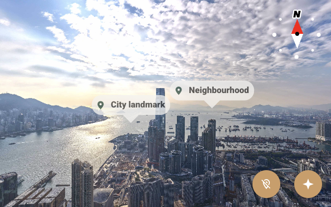
Explore the panorama, zoom into the scene and return to the starting view whenever you need to.
Aerial stories, beautifully told
Turn a 360° photograph into an interactive, branded panorama that helps people explore a place and everything around it.
Panorama processing happens in your browser.
01 / The viewer
Give your audience the freedom to look around, discover nearby places and see the details that matter—all in one immersive experience.
Explore the panorama, zoom into the scene and return to the starting view whenever you need to.
Highlight places and stations with labeled markers, or add links to take visitors somewhere new.
A compass provides an at-a-glance sense of direction as visitors move through the view.
Organize additional images, floor plans and supporting visuals into an accessible image gallery.
Personalize the interface colors, place-tag logo and watermark for each client or project.
Add an edited bottom face with high-resolution tiles to incorporate site or floor-plan detail.
A closer look / Standalone editor
02 / The editor
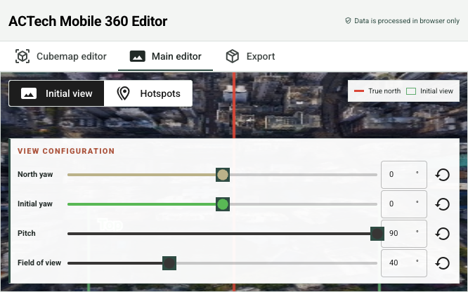
From the first image to the finished experience, the editor gives you the tools to shape every view with intention.
03 / The workflow
A straightforward workflow for creating a panorama that feels considered, useful and distinctly yours.
Choose an equirectangular photograph and convert it into the six faces of a cubemap in your browser.
Choose the opening view, mark important places, add supporting images and customize the visual identity.
Export the data and upload alongside with the viewer.
See things differently
Give people a new way to experience it.